Difference between revisions of "Moved:SCEC UGMS Committee Meeting"
| Line 93: | Line 93: | ||
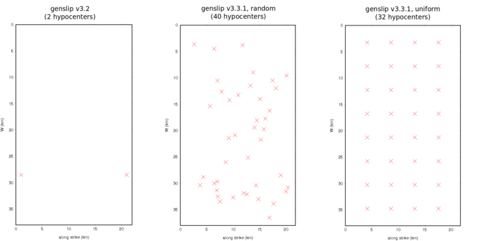
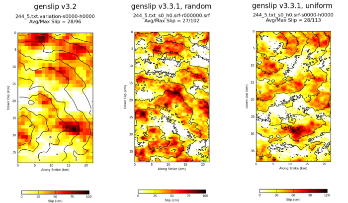
[[File:244_5_slips.png|thumb|700px|left|Slips for a single realization of source 244, rupture 5 (M6.55, Puente Hills)]] | [[File:244_5_slips.png|thumb|700px|left|Slips for a single realization of source 244, rupture 5 (M6.55, Puente Hills)]] | ||
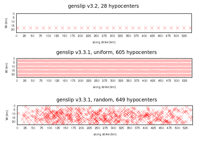
| − | [[File:128_1296_hypos.png|thumb|700px|left|Hypocenter distribution for source 128, rupture 1296 (M8.15, Southern San Andreas]] | + | [[File:128_1296_hypos.png|thumb|700px|left|Hypocenter distribution for source 128, rupture 1296 (M8.15, Southern San Andreas)]] |
Revision as of 23:10, 7 May 2014
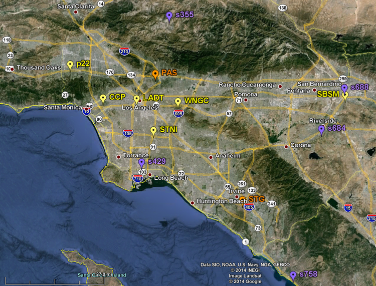
The SCEC Committee on UGMS (see membership and charter below) will meet on May 12th from 10 a.m. to around 5:30 p.m at USC/SCEC in Los Angeles, CA. At the meeting, Tom Jordan (USC/SCEC) and his team will present details of the CyberShake platform, which has completed long period ground-motion simulations for the Los Angeles region. They will present how model uncertainties have been addressed so far and will show results of probabilistic and deterministic calculations. At the end of these presentations the committee will decide the next steps toward the goal of preparing long period ground motion maps for the Los Angeles region, a task that will be performed in collaboration with the SCEC GMSV TAG committee chaired by Nico Luco (USGS).
SCEC Committee on Utilization of Ground Motion Simulations (UGMS):
- Norm Abrahamson (PG&E/UCB)
- John Anderson (UNR)
- Bob Bachman (R.E. Bachman Consulting Structural Engineers)
- Jack Baker (Stanford)
- Jacobo Bielak (CMU)
- C. B. Crouse (URS, chair)
- Art Frankel (USGS)
- Rob Graves (USGS)
- Ron Hamburger (SGH)
- Curt Haselton (CSUC)
- John Hooper (MKA)
- Charlie Kircher (Kircher & Associates)
- Nico Luco (USGS)
- Farzad Naeim (J.A. Martin & Associates)
- Paul Somerville (URS)
Committee Goal/Charter: Develop long-period response spectral acceleration maps for Los Angeles region for inclusion in NEHRP and ASCE 7 Seismic Provisions and in Los Angeles City Building Code. The maps would be based on 3-D numerical ground-motion simulations, and ground motions computed using latest empirical ground-motion prediction equations from the PEER NGA project. The project would be coordinated with (1) the SCEC Ground Motion Simulation Validation Technical Activity Group (GMSV-TAG), (2) other SCEC projects, such as CyberShake and UCERF, and (3) the USGS national seismic hazard mapping project.
Agenda
Data of Interest
CyberShake Hazard Maps
| Site Name | 3 second curve | 5 second curve |
| LADT | LADT 3 sec | LADT 5 sec |
| CCP | CCP 3 sec | CCP 5 sec |
| P22 | P22 3 sec | P22 5 sec |
| s429 | s429 3 sec | s429 5 sec |
| STG | STG 3 sec | STG 5 sec |
| s684 | s684 3 sec | s684 5 sec |
| s688 | s688 3 sec | s688 5 sec |
| PAS | PAS 3 sec | PAS 5 sec |
| s758 | s758 3 sec | s758 5 sec |
| SBSM | SBSM 3 sec | SBSM 5 sec |
| STNI | STNI 3 sec | STNI 5 sec |
| WNGC | WNGC 3 sec | WNGC 5 sec |
| s355 | s355 3 sec | s355 5 sec |


